


les halles

vaud
User
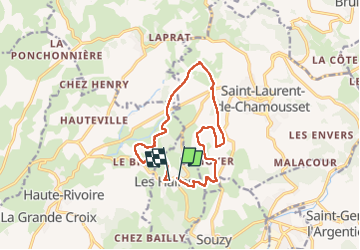

Length
12.6 km
Boucle
Yes
Creation date :
2024-04-14 08:05:59.63
Updated on :
2024-04-14 12:40:10.643
3h27
Difficulty : Medium

FREE GPS app for hiking
 SityTrail
IGN / Geographical institutes
SityTrail Plus
The world is yours!
About
Trail Walking of 12.6 km to be discovered at Auvergne-Rhône-Alpes, Rhône, Les Halles. This trail is proposed by vaud.
Positioning
Country:
France
Region :
Auvergne-Rhône-Alpes
Department/Province :
Rhône
Municipality :
Les Halles
Location:
Unknown
Start:(Dec)
Start:(UTM)
611755 ; 5063896 (31T) N.
Comments